Product Overview
The CryoTEMPO-EOLIS gridded product is a monthly Digital Elevation Model with one product per region, on a 2km grid in polar stereographic coordinates. The monthly product contains 3 months of data on a rolling basis each month and uses the Thematic point product as its input.
- Platform & Acquisition: CryoSat-2 SARin mode
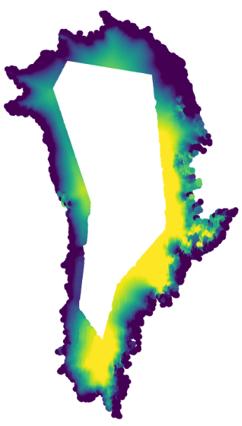
- Geographic Coverage: Greenland Ice Sheet and Periphery, Antarctic Ice Sheet and Periphery, Alaska, Arctic Canada (North and South), Iceland, Svalbard, Russian Arctic, Southern Andes
- Temporal Coverage – Baseline 2: from August 2010, for all regions; the most recent data available corresponds to three months prior to the current month
- Temporal Coverage – previous Baseline (1): from August 2010 for Greenland and Antarctica, and from August 2021 for Iceland and Svalbard
- Temporal Resolution: Monthly
- Spatial Resolution: 2km
- Data Format: NetCDF
- Data Contributors: Noel Gourmelen, Livia Jakob, Carolyn Michael, Martin Ewart, Jerome Bouffard, Alessandro Di Bella, Sophie Dubber, Andrea Incatasciato, Jonathan Alford, Tristan Goss, Oskar Fraser-Krauss
- Cite As:
Data over glaciers – “EOLIS elevation data generated using swath processing of CryoSat-2 data (Jakob & Gourmelen, 2023) and provided by the ESA CryoTEMPO project (https://cryotempo-eolis.org/).”
Jakob, L., and Gourmelen, N., (2023). Glacier Mass Loss Between 2010 and 2020 Dominated by Atmospheric Forcing. Geophysical Research Letters 50(8), 1–10. doi:10.1029/2023GL102954
Data over ice sheets – “EOLIS elevation data generated using swath processing of CryoSat-2 data (Gourmelen et al., 2018) and provided by the ESA CryoTEMPO project (https://cryotempo-eolis.org/).”
Gourmelen, N., Escorihuela, M., Shepherd, A., Foresta, L., Muir, A., Garcia-Mondejar, A., Roca, M., Baker, S., & Drinkwater, M. R. (2018). CryoSat-2 swath interferometric altimetry for mapping ice elevation and elevation change. Advances in Space Research, 62(6), 1226-1242. https://doi.org/10.1016/j.asr.2017.11.014
Data Attributes
The gridded product contains the following variables:
- time (time in seconds)
- x (geographic coordinate) or lon (degrees)
- y (geographic coordinate) or lat (degrees)
- x_bnds (meters, upper and lower x bounds)
- y_bnds (meters, upper and lower y bounds)
- nv (index of nearest vertex, 0 or 1)
- elevation (metres)
- uncertainty (metres)
Coordinate reference system:
For Greenland, Iceland, Svalbard, Canadian Arctic, Russian Arctic, Alaska:
- EPSG:3413 || +proj=stere +lat_0=90 +lat_ts=70 +lon_0=-45 +k=1 +x_0=0 +y_0=0 +datum=WGS84 +units=m +no_defs
For Antartica:
- EPSG:3031 || +proj=stere +lat_0=-90 +lat_ts=-71 +lon_0=0 +k=1 +x_0=0 +y_0=0 +datum=WGS84 +units=m +no_defs
For Southern Andes:
- EPSG:32719 || +proj=utm +zone=19 +south +datum=WGS84 +units=m +no_defs
Documentation
Product Handbook:
The product handbook acts as a user guide and contains high level algorithm descriptions as well as an overview of file structure:
Algorithm Technical Baseline Document:
For more in-depth explanations of underlying algorithms, please refer the Algorithm Technical Baseline Document (ATBD):
Tutorials and Tools
The Demos & Tutorials page contains links to interactive python notebooks, that allow you to download and interactive with the EOLIS gridded product.
Feedback and Queries
Feedback or questions about the CryoTEMPO-EOLIS Thematic Products is welcomed. Please use the following contact details:
E-mail: support@cryotempo-eolis.org
Or alternatively, get in touch using our Contact Form
cs2eo.org:
The CryoTEMPO-EOLIS download service provided by cs2eo.org allows for interactive visualisation of available gridded product data. It provides a flexible, user-friendly service for querying the data, allowing you to:
- Specifiy a query area using Lat/Long or a drawn polygon
- Specifiy the start and end dates and times of your query
- Immediately visualise the data coverage of the results of your query
To get started as new user, navigate to one of the Custom Query Examples shown below and explore the possiblities.