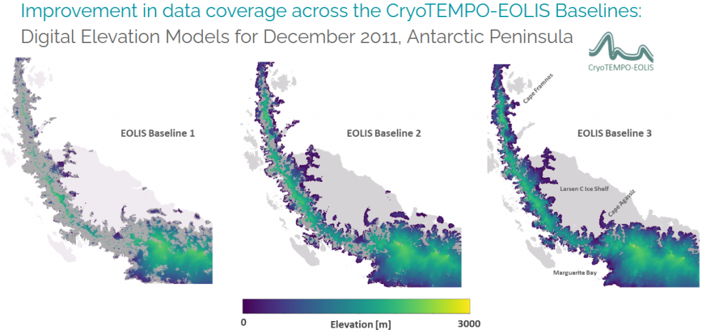
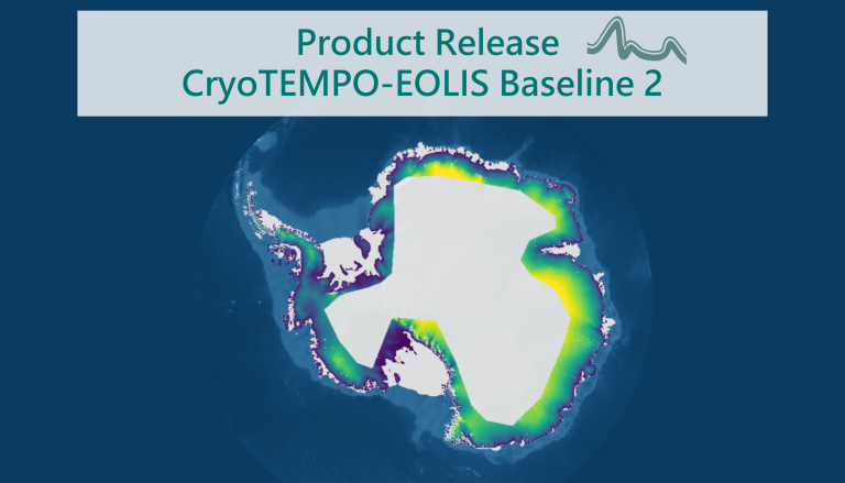
The CryoTEMPO-EOLIS dataset, developed to monitor elevation change across the world’s glaciers, ice sheets and ice shelves using swath radar altimetry from ESA’s CryoSat-2 satellite, has reached a new milestone with the release of Baseline 3.
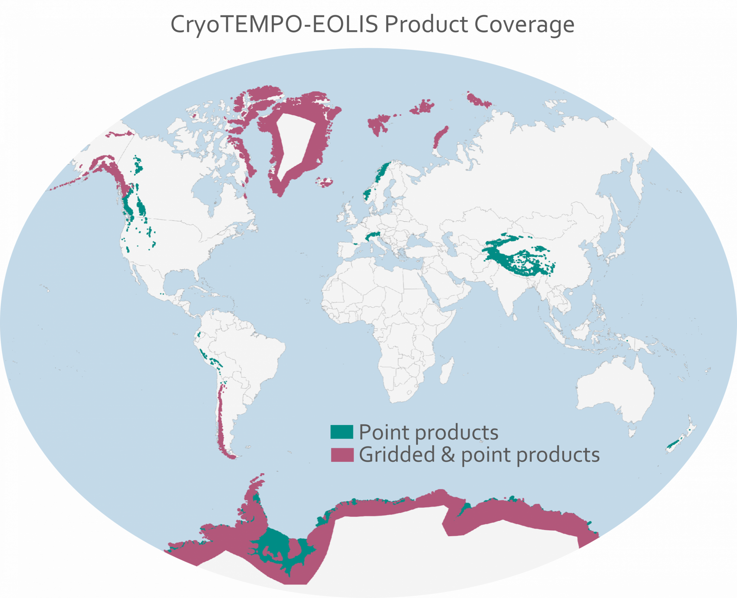
Products based on Baseline 3 are now available from January 2026 onwards for all regions, including glaciers, ice sheets and ice shelves. In the coming months, the entire CryoSat-2 record will also be reprocessed back to July 2010, providing a consistent long-term dataset.
CryoTEMPO-EOLIS Baseline 3 introduces several improvements:
Increased data density and spatial coverage in both the point and gridded products, particularly in complex terrain such as mountain glaciers and ice sheet margins
Improved measurement quality, resulting in more reliable elevation estimates
More robust uncertainty estimates using a new error metric
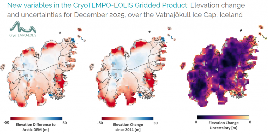
New variables:
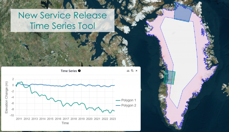
Elevation change from a reference period, enabling users to visualise height change patterns and quantify volume change (gridded product only)
Elevation difference from a reference Digital Elevation Model (DEM) (point and gridded products)